Leave a Message

Thank you for your message. We will be in touch with you shortly.

How Parker County Acreage Is Really Priced

How Parker County Acreage Is Really Priced

Ever heard a per-acre price tossed around that sounded too good to be true? In Parker County, the number you see online or hear at the feed store often hides key details that swing value by tens of thousands per acre. If you are thinking about selling land or buying acreage, you deserve a clear, local playbook on what truly moves the needle.

In this guide, you will see the real drivers behind per-acre pricing, how local sold examples translate into value, and a simple framework you can use to sanity check a tract before you list or make an offer. Let’s dive in.

What sets the per-acre number

Road access and corridors

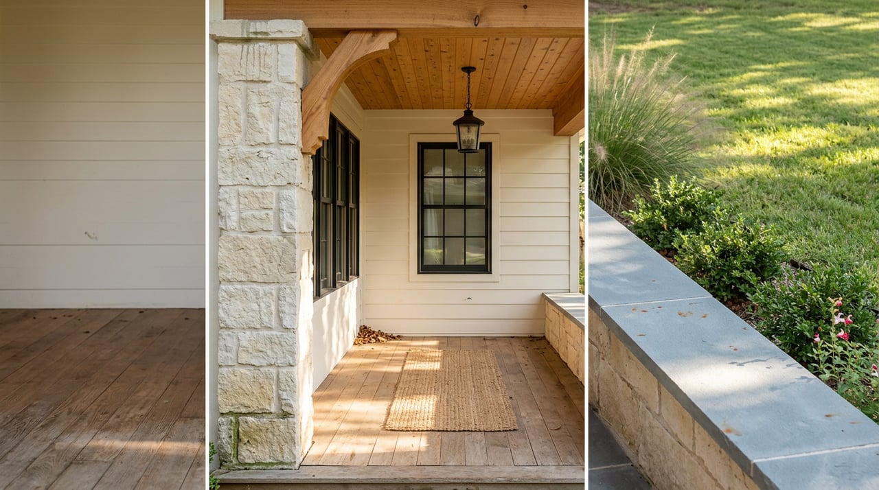
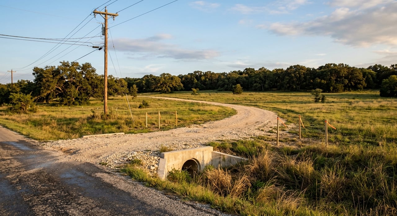
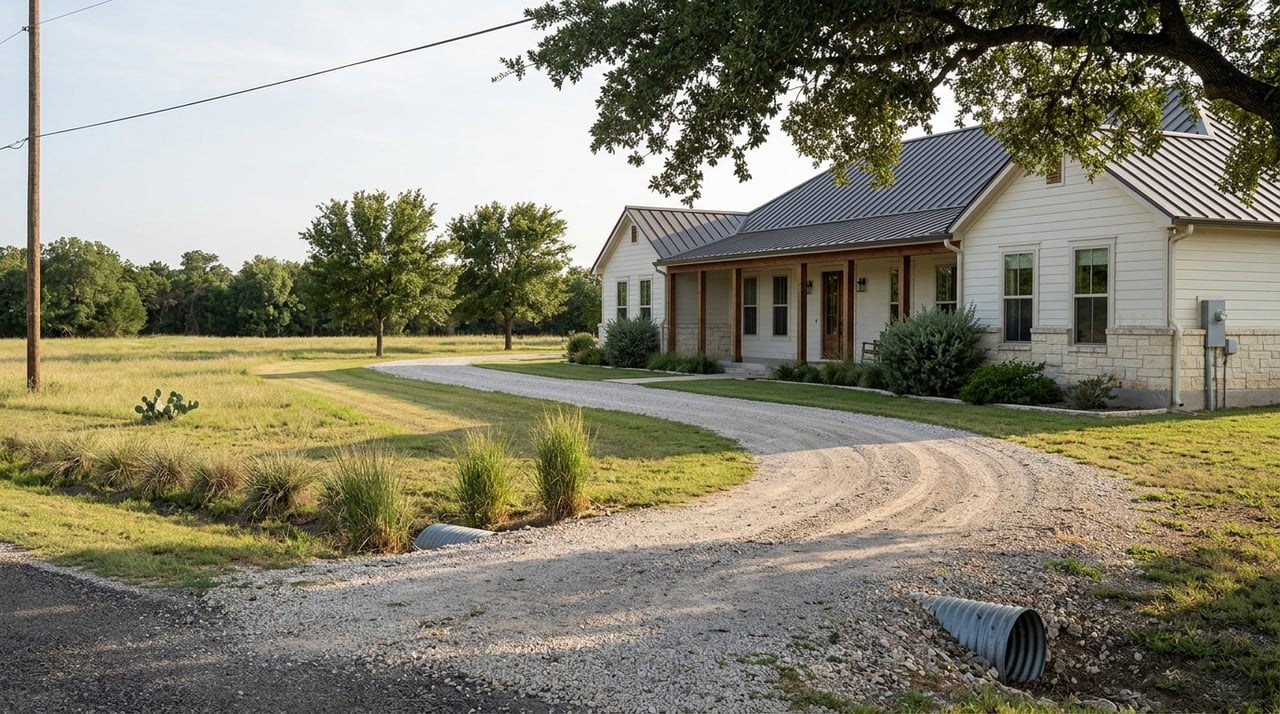
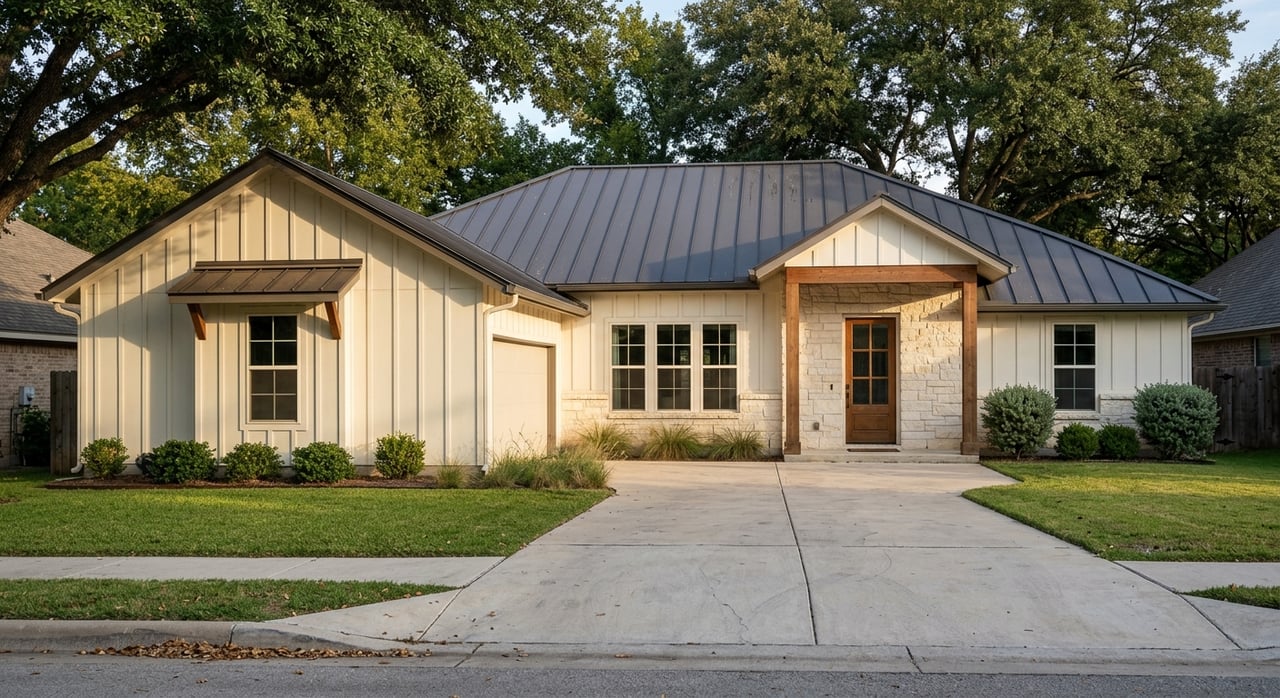
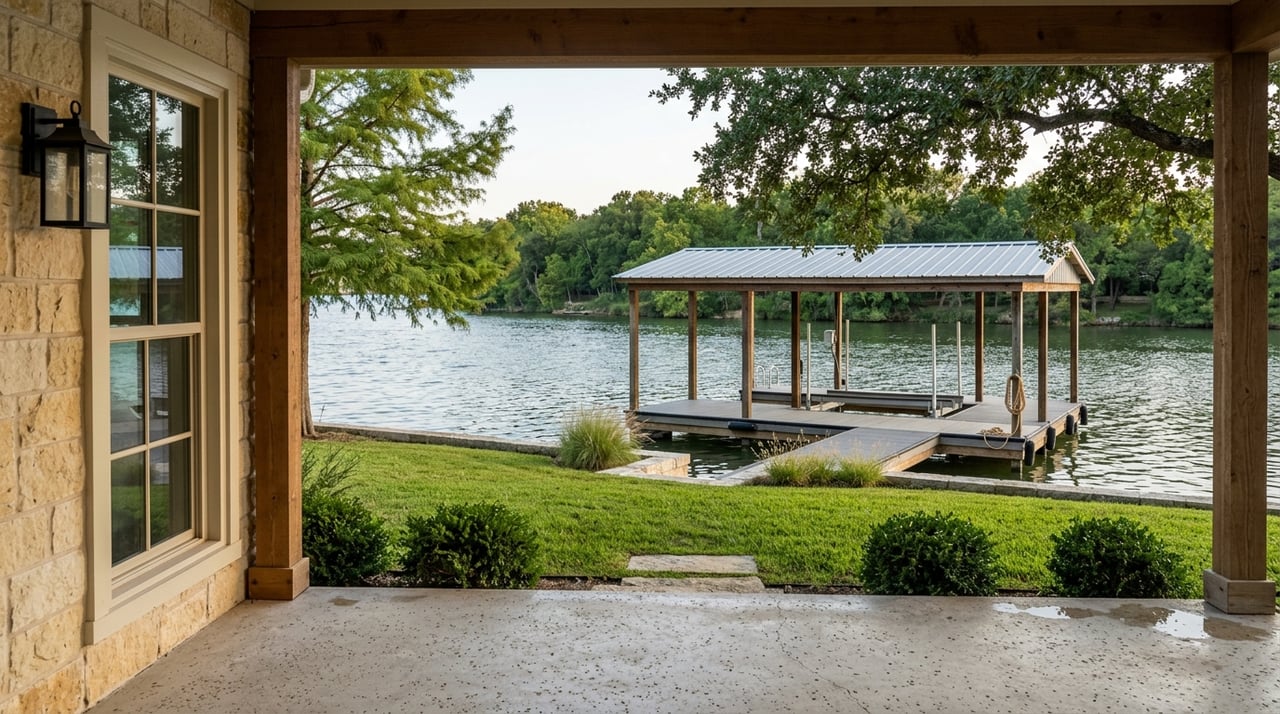
Access is often the first value gate. Paved frontage on a Farm-to-Market or state highway near Weatherford or along US 180 means easier permitting, better visibility, and a bigger pool of buyers. Proximity to commuter corridors into Fort Worth can generate strong demand for small tracts and ranchettes. For context on the corridor, see this look at US 180 in Weatherford.

  • Parcels with paved frontage and quick corridor access can trade at a multiple over similar-sized acreage tucked on a private gravel road.
  • Developers and ranchette buyers value reduced site-improvement costs and time-to-build, which lifts per-acre numbers.

Utilities and services

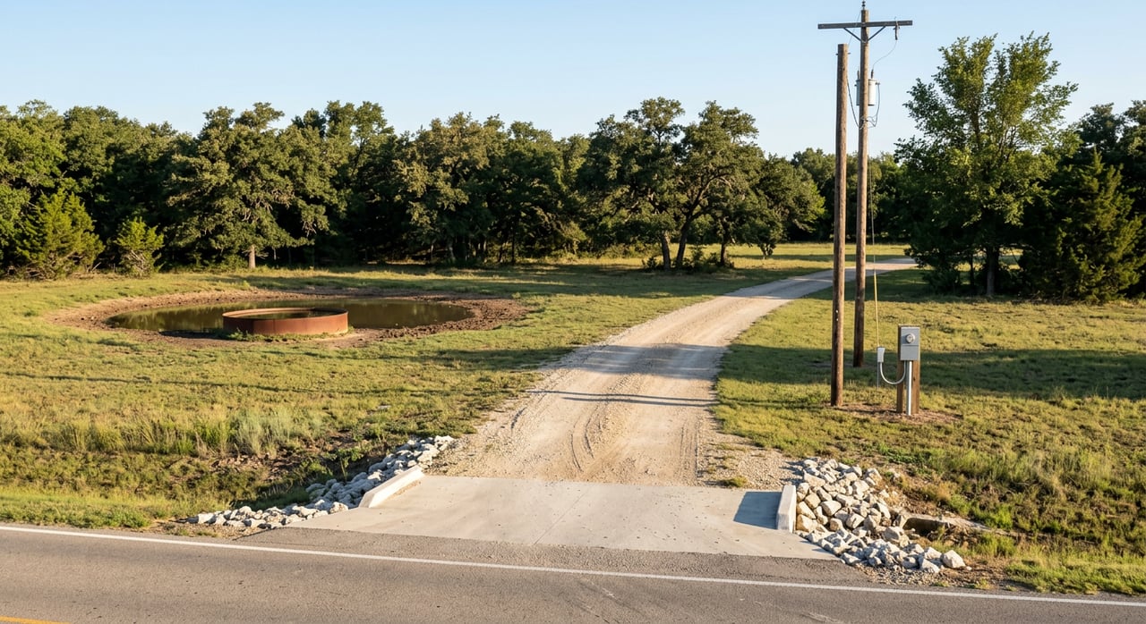
Electricity is generally delivered by Oncor in much of Parker County, with municipal utilities inside city limits such as Weatherford. Where public water or sewer is near the property line, land often becomes build-ready. Where they are not, buyers plan for wells and septic.

  • Septic feasibility matters. The state outlines on-site sewage rules, permitting steps, and when engineered systems are required. Review the TCEQ’s OSSF permitting guidance early.
  • Inside Weatherford city limits, check water and electric availability up front using the city’s utility FAQs. A simple service letter can protect value and negotiation leverage.

Topography, soils, and drainage

Slope, rock, and soil types influence usable acreage and construction costs. In parts of the Cross Timbers terrain, shallow rock or expansive clays can push foundation design and driveway costs higher. When acres are steep, rocky, or flood prone, the true “marketable” portion of a tract shrinks.

  • Use the county soil survey to flag potential limitations and plan improvements. The Parker County soil survey is a solid starting point for due diligence on local soil types and constraints.

Water supply and groundwater rules

Private wells and stock ponds are common. Parker County lies within the Trinity aquifer system and falls under planning for Groundwater Management Area 8. Spacing rules and permitting can affect how you split land and the long-term reliability of wells.

  • Start with the TWDB’s GMA 8 information and district contacts for rules and planning context: GMA 8 groundwater resources.
  • Keep an eye on regional supply work, like the Turkey Peak Reservoir project, which can influence long-term service options for edge-of-county parcels. Learn more at the Turkey Peak Reservoir project site.

Development potential and local regulation

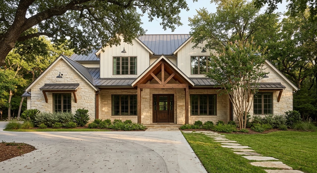
If a parcel is already platted, has recorded lots, or has nearby water and sewer, it can price far above raw, unplatted acreage. County and municipal processes in the ETJ, plus neutral factors such as attendance zones for districts like Aledo ISD, Weatherford ISD, and Brock ISD, shape the most likely end-buyer and intended use.

  • Appraisers treat “development readiness” as a separate value component because it expands the buyer pool and shortens timelines.

Taxes and special valuations

Agricultural or open-space valuation can reduce holding costs for owners who maintain qualifying use. If land is later converted to non-ag use, rollback taxes may apply.

Real sold examples and size effects

Small, well-located parcels with improvements trade very differently than large recreational tracts. Recent local examples help illustrate the point:

  • A 63.91-acre tract in the Weatherford area closed near 3.3 million, which is about 51,600 per acre. The listing emphasized commercial and development potential. That kind of use case supports a higher number.
  • A 25-acre parcel near Lake Mineral Wells closed around 1.15 million, or about 46,000 per acre. Improvements such as electric, a pond, and fencing helped support the price.

Now compare those to larger acreage. Public summaries for 100 to 200-acre recreational tracts in Parker and adjacent counties show averages around 20,000 per acre in 2024. These larger, more remote parcels often have limited road frontage and utility access, so the per-acre average sits much lower.

The takeaway is simple: size and use drive the analysis. A 15 to 30-acre ranchette with paved frontage and utilities may support a number several times higher per acre than a 150-acre recreational place 20 minutes farther out.

How to estimate your tract’s value

Use this practical, appraisal-style framework to convert features into a per-acre range:

1) Define highest and best use

Is your tract best suited for a ranchette subdivision, estate homes, recreational ranch, or commercial frontage? This choice determines which sales are relevant.

2) Segment by size and location

Pull closed sales in the same corridor and, when possible, in the same attendance zone. Separate them into small tracts under 50 acres, mid-sized 50 to 200 acres, and large tracts above 200 acres. Texas-wide research confirms the strong size effect across regions. For a statewide read on size and regional patterns, see the Texas A&M Real Estate Research Center’s latest rural land report.

3) Remove improvement value

Back out the value of homes, barns, arenas, and stocked ponds to isolate land value. Use cost data, paired sales, or recent construction numbers for a reasonable adjustment.

4) Adjust for access and utilities

Add or subtract based on frontage quality, distance to major corridors, and availability of water, sewer, and electric. A confirmed water line or sewer main near the boundary can be a high-impact bump.

5) Apply site-specific factors

Adjust for usable acres, slope, soil, and septic feasibility. If a well is present, depth and yield can support higher density or faster development timelines.

6) Produce a range

Present a three-point range: low, typical, and high. Then note the premiums that push a parcel toward the top of that range: paved frontage, existing utility taps, gentle topography, a reliable well or pond, and proximity to Weatherford or commuter routes.

Due diligence checklist before you price

Work this list to protect value and avoid surprises after you go under contract:

  • Taxes and valuation status. Confirm assessed value, tax rates, and whether the parcel carries an agricultural or open-space appraisal with the Parker County Appraisal District. Review recent tax bills and exemptions.
  • Title and legal. Order a title commitment to confirm the legal description, easements, and any mineral reservations. Use the county clerk’s records for chain-of-title research.
  • Septic feasibility. Schedule a site and soil evaluation by a TCEQ-licensed professional. Start with the state’s OSSF permitting page to locate the right local authority.
  • Well feasibility. Review nearby well logs and spacing rules. The TWDB’s GMA 8 page links to district contacts and planning resources: groundwater overview.
  • Soils and slope. Run a Web Soil Survey and study the Parker County soil survey for limitations that impact septic, roads, or foundations.
  • Road status and access. Verify whether access is public or private, and confirm any needed approach permits if fronting a state-maintained road.
  • Utilities. Request water and electric availability letters. If inside Weatherford’s service area, start with the utility FAQs. For areas outside city limits, contact Oncor and local water supply corporations.
  • Flood and environmental. Pull FEMA flood data and check for wetlands or sensitive habitat. If constraints exist, map them early and plan around them.

Parker County market context

Parker County’s steady growth keeps land demand resilient. The U.S. Census estimated the county’s population at 179,707 as of July 1, 2024, continuing a post-2020 rise. See the official snapshot at U.S. Census QuickFacts.

Statewide, rural land prices surged through 2020 to 2022, then cooled and normalized in 2023 to 2024, with wide variation by region and tract size. The Texas Real Estate Research Center tracks these patterns and confirms that smaller tracts near major metros often trade at a premium compared to large ranches. You can review their methodology and regional charts in the latest statewide report.

Active listing sites can be useful for gauging market tone, but they reflect asking prices, not closed-sale evidence. Treat them as context while you anchor your valuation to recent closed sales and the specific features of your tract.

Seller tips to lift value

Small steps before you list can move your per-acre number into a higher range:

  • Secure access. Clarify and record any access easements. If fronting a state highway, research approach requirements early.
  • Verify utilities. Obtain written water and electric availability. If sewer is close, document distance and any extension costs.
  • Map usable acres. Flag buildable areas, potential homesites, and any flood or steep zones so buyers quickly see what is workable.
  • Address septic and well questions. Share a recent septic site evaluation or well data if available. Buyers pay for certainty.
  • Organize documents. Keep survey, title documents, tax statements, and any ag-valuation records in one digital package.
  • Plan your audience. If the highest and best use points to ranchette splits, consider early platting steps or concept plans to demonstrate potential.

When your land is properly prepared and marketed, you attract the right buyers and stronger offers. If you want an expert set of eyes on frontage, utilities, soils, and development potential, the local team at Lori Mayo Real Estate Group is ready to help.

FAQs

What drives small-tract per-acre prices near Weatherford?

  • Paved frontage, quick access to US 180 or I-20 corridors, confirmed utilities, and light improvements like fencing or a pond often lift 10 to 30-acre parcels into higher per-acre ranges compared to raw, backroad tracts.

How do ag valuations and rollback taxes affect sellers in Parker County?

  • Special ag or open-space appraisal lowers annual taxes while qualifying use continues, but if you convert to non-ag use, rollback taxes may apply; review the Texas Comptroller’s rules before listing or subdividing.

How can I check if my land can support a septic system?

  • Hire a TCEQ-licensed professional for a site and soil evaluation and confirm permitting with the proper authority; TCEQ’s OSSF page outlines the process and local contacts.

Where do I verify groundwater rules and well feasibility?

  • Start with TWDB’s GMA 8 resources and contact the local groundwater district for spacing and permit rules, then review nearby well logs to understand depth and yield patterns.

What adds the most value before listing rural land?

  • Clear, documented access, utility availability letters, a recent survey, basic land cleanup for visibility, and a simple concept plan that shows homesites or potential splits help buyers see value fast.

Work With Us